

Tracking Water Consumption
By: Operations Department
Published in:
SDGs : SDG 06 | Units: Administration | Time: 2024-ongoing | Link
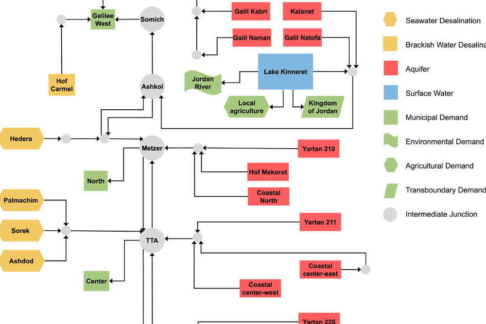
Description: Water consumption is closely monitored on several levels: Overall water consumption , Water consumption per building and Water consumption for gardening & irrigation The table below presents water consumption for various buildings for weekends only. As activity during the weekend tends to be less extensive, variations in the Baseline Consumption can be detected. (more…)